Reigniting visitors’ curiosity is key to improving their experience in museums and galleries. As visitors become younger in age, the demand for interactive experiences rises. It’s no longer entertaining enough for a museum to promote “walking around and looking” as a way of learning. ARway provides that needed spark with augmented reality (AR) spatials with its no code platform.
Attract Younger Visitors With Engaging and Immersive Exhibits
ARway, the technology of the present, sets museums and galleries up for the future. With a 2.6 billion user market, Gen Z are museums’ future donors and sponsors, so it’s critical to incorporate exciting elements to get their attention. The latest data shows museums easily attract audiences 35 to 44 years old, but struggle with younger ones from 18 to 24 years old. Millennials and Gen Z, who make up 63% of Earth’s population, expect exhibitions to not only educate them but entertain them. It must be an interactive learning and tactile experience that’s also worthy of social media. The younger generations tend to flock to science museums at a greater rate than the national average, demonstrating the demand for an interactive and technological visit.
For museum stakeholders, this may seem like too high of a standard to fulfill for this younger audience. How can they check off everything on their list of expectations? Yet museums around the world can implement ARway’s AR Spatial capabilities to display enticing exhibits and reel in younger visitors. Let’s take a look at a few ideas.
AR treasure hunts within exhibits
The power and reach of AR is no better explained than through Pokemon Go. With the app downloaded over 1 billion times, users thoroughly enjoyed searching for and catching animated creatures superimposed onto their world through their phone’s camera.
The National Museum of Singapore had a positive response from the public on the AR treasure hunt they implemented during one of their exhibits, allowing visitors to hunt for items within paintings and add them to their personal virtual collection while they explore the museum as well as expand their knowledge; users learn facts such as habitat, diet, and rare species from collecting.
Interactive displays
Another powerful tool that elevates the experience of museum visitors is leveraging interactive displays. Studies report that 84% of visitors feel more engaged and find an exhibit more memorable if it has AR elements. Museums and art galleries are actively taking those findings into account, and shifting towards incorporating more and more interactive displays into their exhibits, thus encouraging a new way to digest art.
The Cleveland Museum of Arts is one of the most advanced facilities when it comes to its usage of AR. It boasts an AR pottery-making stand where a spinning block of clay is moulded as visitors’ movements mimic as if they were in front of an actual pottery wheel. How little or large their gestures change the width of their digital asset which they can then design with different patterns.
Immersive exhibit activations
AR extends users’ content dwell time by upwards of 2.31 seconds and 39% of users re-engage with content containing AR elements. Any museum can take advantage and bring a display or art piece to life with a simple ARway Spatial. While visitors may usually walk past a display of bones or a skeleton, museums can catch their attention by bringing them face to face with extinct animals through a digital representation or travelling to a different century through a painting.
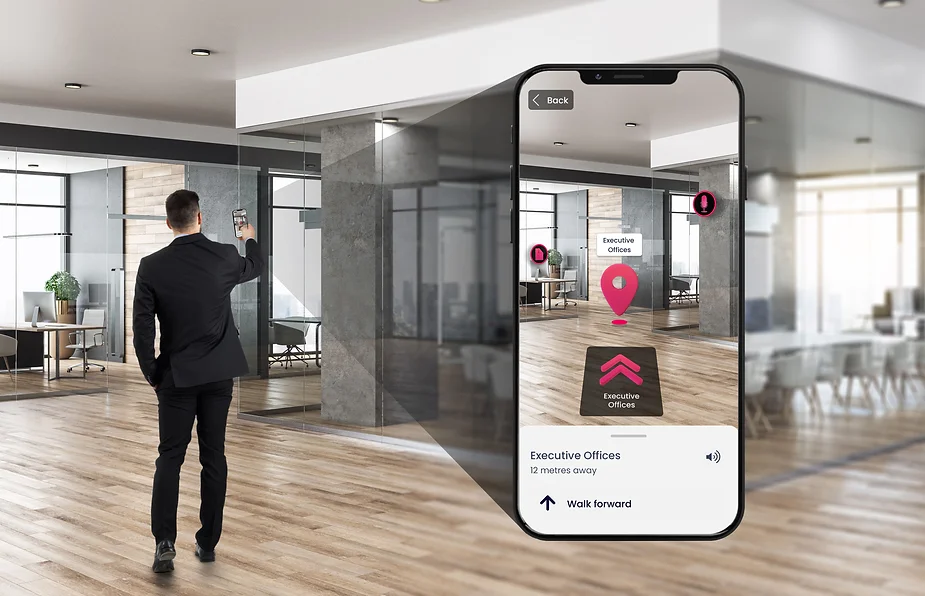
Improve Indoor Navigation and Drive Foot Traffic To Desired Areas

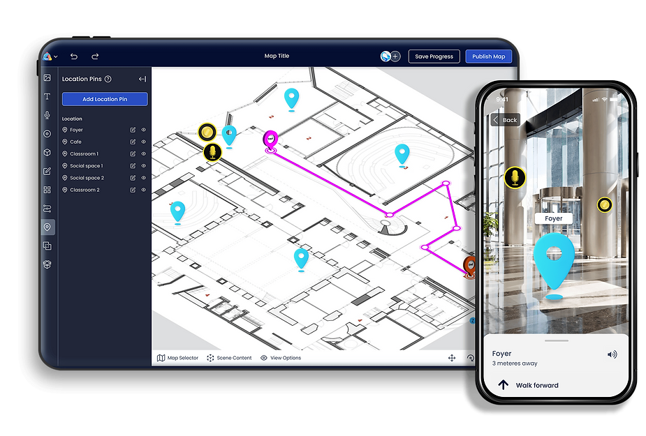
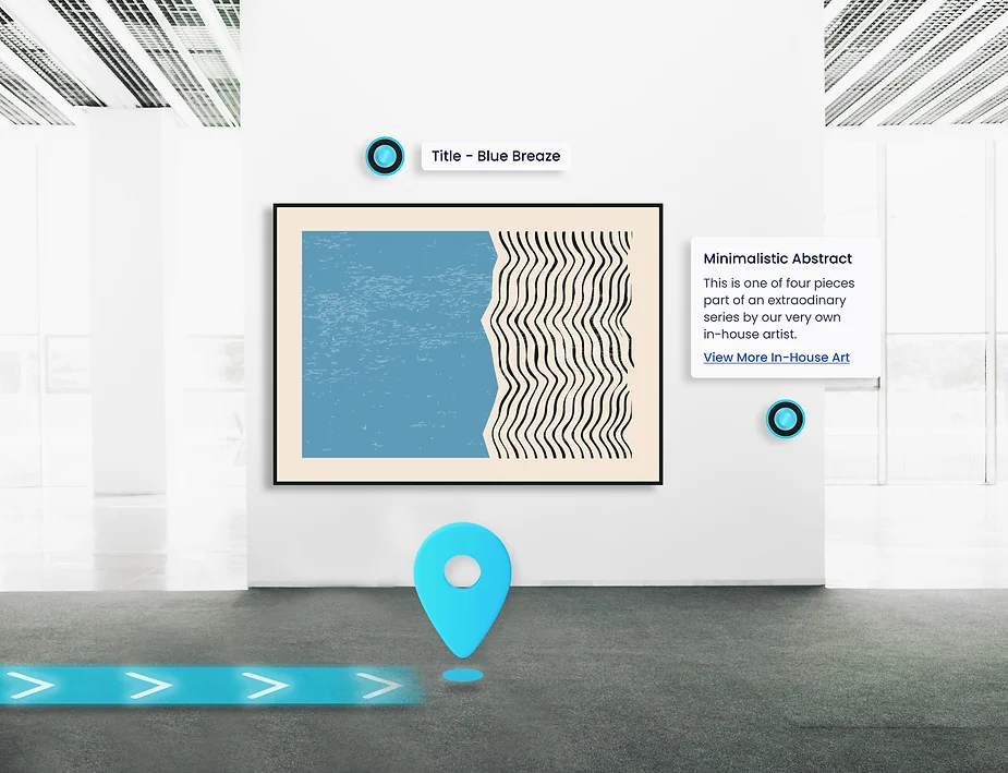
AR navigation path in an art gallery with 2 hotspots describing a painting.
Museums will capture attention with the appeal of interactive ARway Spatial elements on display, but the work doesn’t stop once visitors come in. Large spaces like museums and galleries are prone to navigation difficulties, with 61% of people reporting it as one of their major frustrations. Employees walking around are often stopped for directions to a specific exhibit or visitors are handed paper maps when first entering to help combat the issue, but it’s simply not enough.
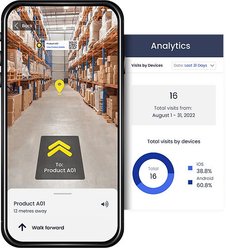
By providing ARway’s real-time, interactive MetaMap, museums and galleries can guide users step-by-step to their desired destination or a notable exhibit the museum wants to highlight and push foot traffic towards. AR navigation is 2x faster than 2D navigation using signage, as AR navigation employs text boxes, arrows, and lighted paths to make navigation simple whereas a 2D map isn’t reactive to a visitor’s location and can’t adjust.
Within a MetaMap, museums and galleries can list a directory of all exhibits and let visitors know what art pieces they can expect to find in different areas. Not only is a visitor’s museum experience enhanced by reducing the friction of locating exhibits with AR wayfinding and providing more information, but there is more available information and context by offering curated and self-guided MetaTours of exhibits to further free up employees and improve efficiency. ARway’s MetaMaps require nothing more than a smartphone to scan your environment due to the advanced artificial intelligence technology.
Reduce Costs of Staging and Operating Temporary Exhibits

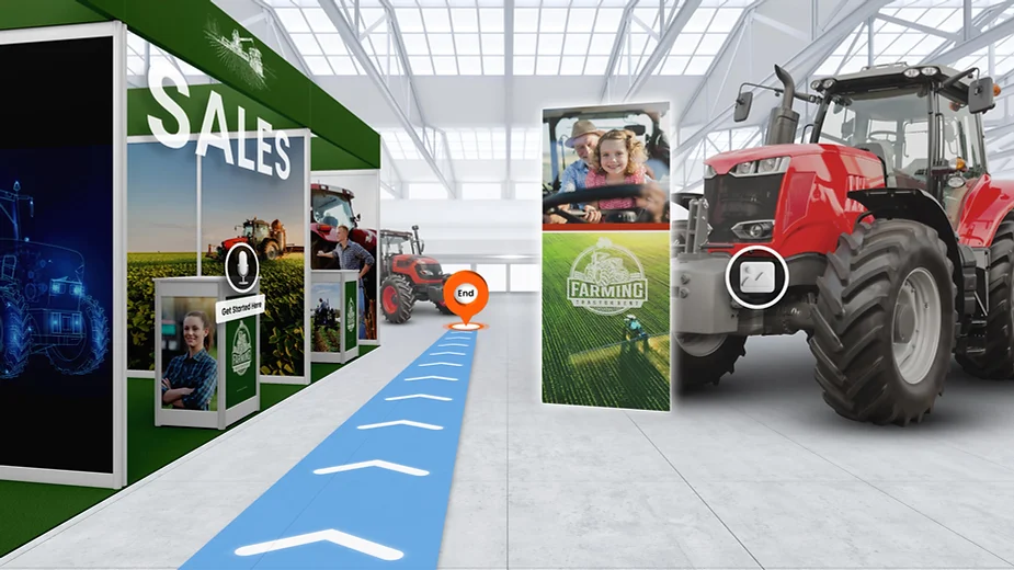
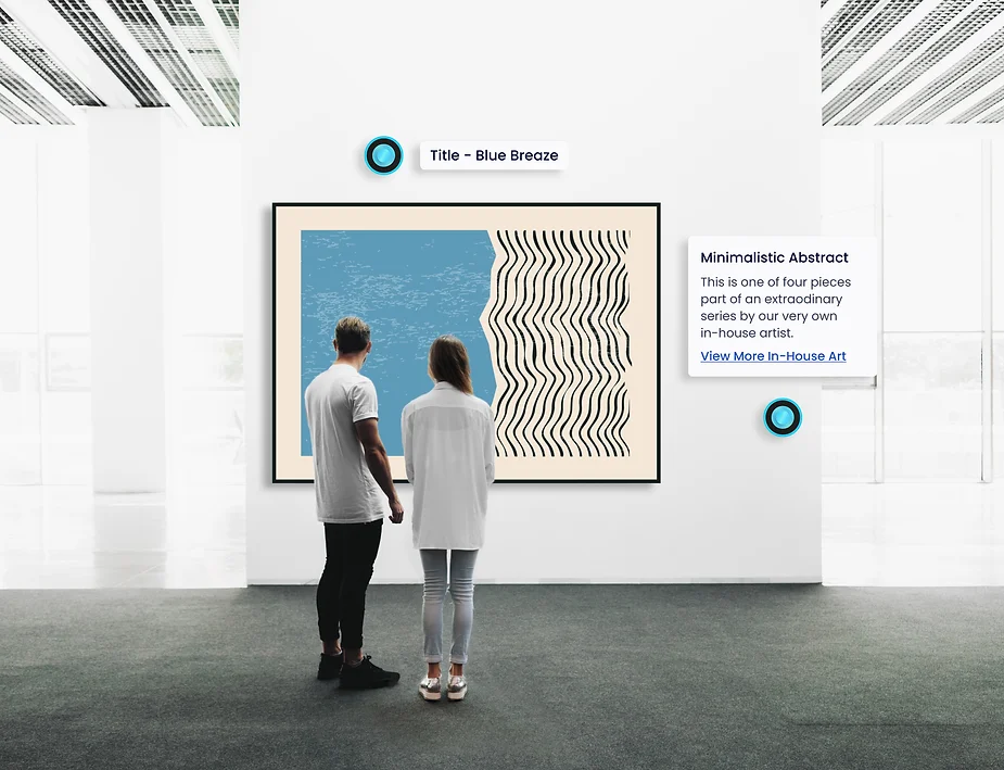
A visitor scanning a QR code and seeing an AR exhibit in front of them.
A temporary exhibit is an exciting way to generate more foot traffic and buzz around a museum and gallery. However, the temporary aspect means installation, transport and insurance of artifacts, employment of temporary staff and production of audio guides, marketing and advertising of the exhibits, and production and distribution of merchandise. This amount of labor equates to $100,000+ USD to stage and operate an exhibit that runs for around four months. If extensive use of multimedia is involved, it’s $350/ft².
By employing AR via ARways Spatials, MetaTours, and MetaMaps, museums and galleries have the advantage of showcasing thrilling temporary exhibits at a much lower cost. Since AR requires nothing more than a smartphone which an estimated 6.6 billion people own, it’s an incredibly accessible technology. There’s no need for temporary staff and audio guides when a Spatial of the artist narrates and provides context. Marketing becomes AR banners as visitors navigate the MetaMap – there’s an AR application to make the process convenient for museum stakeholders while still being compelling for visitors.
Expand Exhibit Capabilities Beyond Physical Limitations
What visitors to a museum or gallery might not know is that what they see on display is not everything the institution has to offer. The Museum of Fine Arts in Boston, for example, is only capable of displaying 4% of their total inventory at any one time, meaning visitors are missing out on over 400,000 art pieces. There are simply too many physical constraints that prevent everything from being displayed, but AR versions are accessible to visitors at all times. Even pieces and collections that have been lost, destroyed, or can’t be exposed to light have the potential to shine and be explored by visitors.
While a museum or gallery’s ambitions may not line up with their resources, AR technology is a spectacular digital innovation that can even allow institutions to bring in world-famous artwork even on a tight budget. Museums can offer pieces in digital formats, allowing visitors to explore in great detail via their mobile devices.
Implementing AR in artwork enables artists to share stories about their pieces and add an extra layer of context from the source themselves. A Spatial activation of the artist can pop up and reveal a painting’s meaning through written information and tell a story about featured personalities without interference with the exhibition design. They can also reveal what they used to create the colors, and what fabric and frame they chose, which for people who appreciate art and attend exhibitions will be of interest.
Museums and galleries must enter the digital age if they wish to stay relevant to the future generation. Innovative digital AR technology is a great complement to the physical pieces and artifacts we hold great value for.
Interested in adding AR technology to a museum or gallery? Visit ARway.ai to learn more.